22 Hiking Trails for All Levels
What greater way is there to explore the Sequoia and Kings Canyon Region than on a hike? If you’re looking for a comprehensive list on hiking trails for all levels, our friend, April provides this helpful guide. To read more about her life’s adventures, and please visit her site. Enjoy this incredibly helpful article on 22 hiking trails in Sequoia and Kings Canyon courtesy of The Unending Journey.
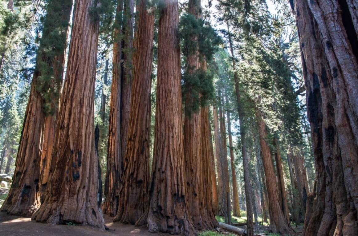
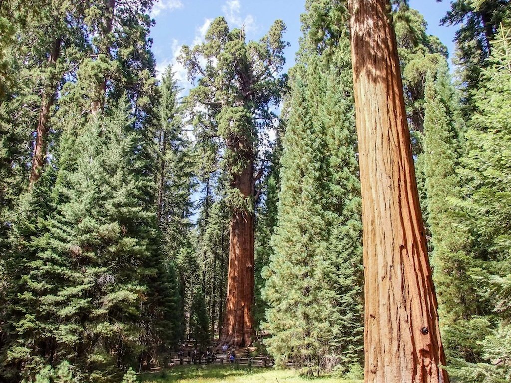
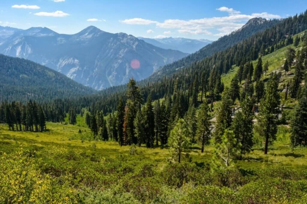
Towering red giants. Endless peaks of mountain ranges. Idyllic meadows. Waterfalls. But, there’s so much more to experience in Sequoia and Kings Canyon National Parks. And, the best way to explore these incredible parks is on the trails. Hiking Sequoia and Kings Canyon allows you to truly understand what these national parks are all about. If you stick to just what you see from the road, you’ll miss over 90% of what makes each park so spectacular. The colossal sequoias are just a start.
Sequoia became a national park in 1890 with Kings Canyon following in 1940. The two parks are connected by Highly 198, also known
Below are 22 amazing hiking trails that you can do in Sequoia and Kings Canyon National Parks. These trails showcase the amazing diversity of the parks as it isn’t just about the sequoias. The list is by no means everything you can hike. It’s only the beginning. And, once you start on the trails, you won’t want to stop. All distances provided are round trip.
Easy Hikes
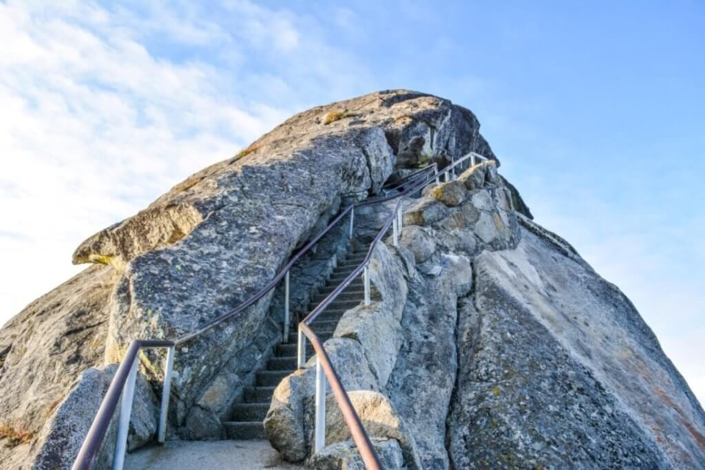
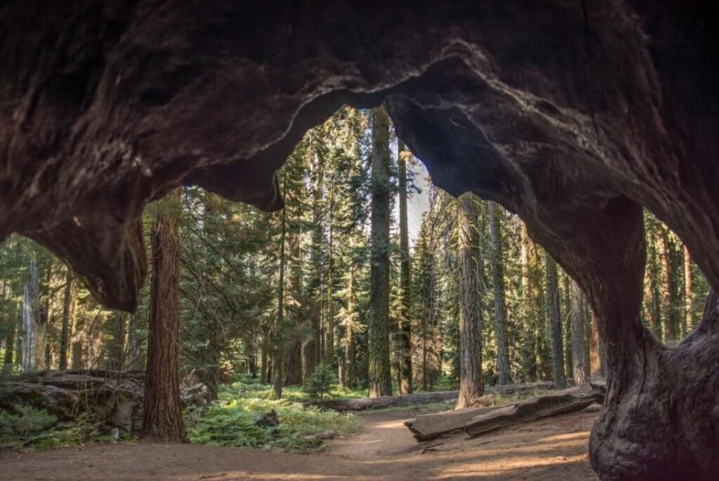
Moro Rock – 0.4 miles

One of the shortest hiking trails in Sequoia National Park is Moro Rock. Though, if you have a fear of heights, you may want to skip this one. But, the views from the top are unparalleled. If you enter Sequoia National Park via the southern entrance, you’ll see Moro Rock for much of the drive up. It’s a short climb up this monolith, but the path and stairs are narrow. And, there’s about 360 steps to the top. But, the views of the Sierras are amazing. Every trip to Sequoia for me starts with a visit to Moro Rock.
Next to Moro Rock is the start of the Sugar Pine Trail. It’s an easy 1.4 mile loop trail that offers unique views of Moro Rock that also connects to the Crescent Meadow area, which is filled with interconnecting hiking trails in Sequoia.
Trail head is located on Crescent Meadow Road near the Giant Forest in Sequoia National Park. Restrooms are located next to the trail head.
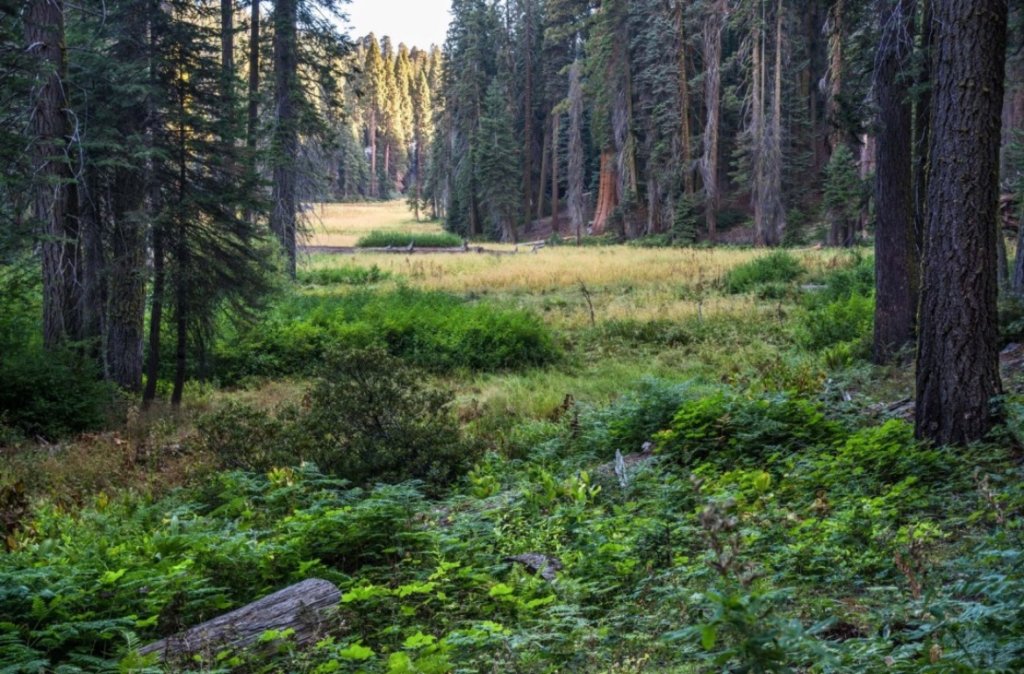
Crescent Meadow – 2 miles

Called the “gem of the Sierras” by John Muir, the easy hike around Crescent Meadow is pure delight. Stunning meadows sprinkled with a few sequoias, it’s a relaxing time in nature. This hiking trail in Sequoia can be made slightly longer by taking the spur trail along Log Meadow to visit Tharp’s Log and Chimney Tree.
Pioneer Hale Tharp spent his summers in Sequoia. And, he transformed a fallen giant into a log cabin complete with fire place. It’s a fascinating look at early life in these woods. Chimney Tree is the remains of sequoia that was hollowed out by fire.
From Tharp’s Log, you can also take a connecting trail (2.5 miles) to the General Sherman Tree. It’s possible to spend the entire day on the many connecting hiking trails in Sequoia in the Giant Forest area. From the Sherman Tree, you can loop back to Crescent Meadow via the Trail of the Sequoias (see difficult hikes below for more info).
The trail head is located at the end of Crescent Meadow Road (continuing past Moro Rock and Tunnel Log), which is by the Giant Forest Museum in the southern part of Sequoia National Park. Restrooms, bear boxes, and picnic tables are near the parking lot. In the summer, the park’s free shuttle makes a stop at Crescent Meadow.
Giant Forest/Big Trees Trail – 0.8 miles
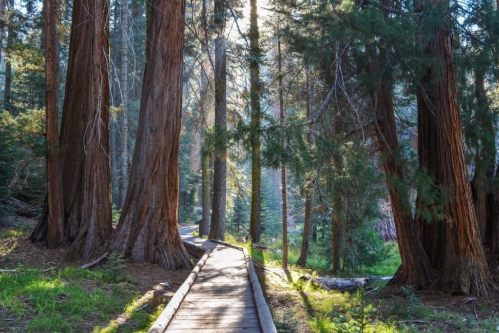
The Giant Forest is the second largest sequoia grove in the world. And, the trees here are just incredible. No matter how many times I’ve passed through, I’m blown away by these sequoias. The Big Trees Trail may be one of the easiest hiking trails in Sequoia. And, you don’t have to exert yourself to see many impressive Sequoias. The best views are along the path surrounding the Round Meadow. This fully accessible trail provides lots of information about the groves and the tree themselves. Don’t forget to stop at the Giant Forest Museum for more information.
Parking is directly off the General’s Highway near the turn for Moro Rock in the southern portion of Sequoia National Park. Restrooms are available at the museum. Top tip – get here early! During the summer and weekends, this place gets crowded!
Long Meadow – 2 miles

Located in the Wolverton area, Long Meadow is an easy hiking trail in Sequoia National Park without the crowds. A relaxing loop trail takes you around the picture-perfect Long Meadow where you may spy deer or even a black bear. Though there’s little elevation gain in the trail itself, the meadow does sit at an elevation of 7,250 ft. If you’re not used to such heights, you may find yourself moving slowly. Always have water with you.
Trail head is located at the parking lot at Wolverton, which is 2 miles past the General Sherman Tree. Restrooms are available by the parking lot.
Tokopah Falls – 3.4 miles
With very little elevation change and idyllic scenery, Tokopah Falls is a popular hiking trail in Sequoia. The trail runs parallel to the Kaweah River past towering granite cliffs to the gorgeous Tokopah Falls. Cascading down 1,200 feet, the falls make for a wonderful place to have a picnic. Early in the season, the falls are stunning. Going later in the year (September), the falls may only be a trickle.
But, at trail’s end, there’s also amazing views of the monolith, the Watchtower. And, you can count on seeing wildlife along the trail. No matter when you go, its a delightful hike in Sequoia.
Trail head is located next to the Lodgepole Campground. Parking is available past the ranger station. Restrooms and hydration stations are at the nearby visitor center.
Grant Grove – 0.8 miles
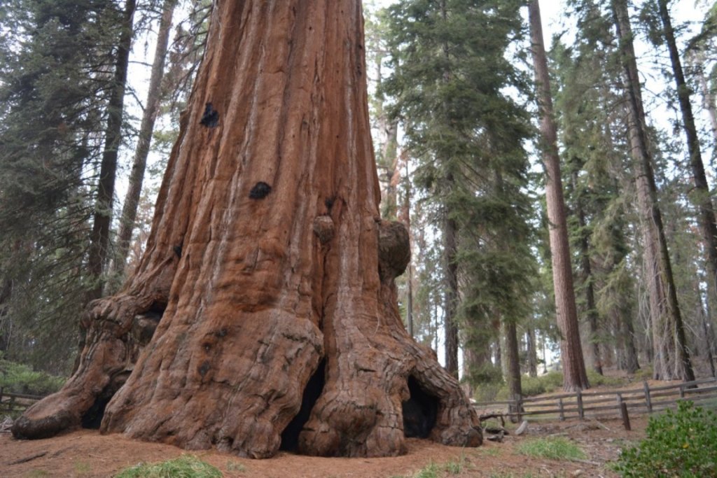
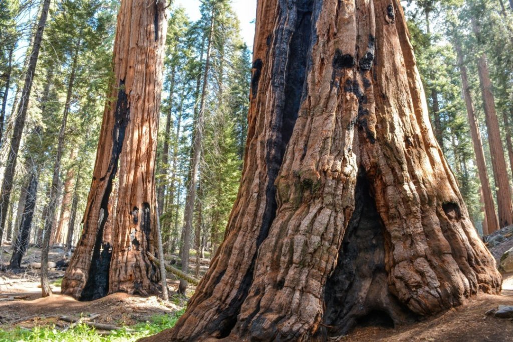
Grant Grove is home to the world’s second largest sequoia (by volume), the General Grant Tree. Along this paved path, you pass many impressive sequoias. You can even walk along the inside the Fallen Monarch. And, there’s the sad sight of the Centennial Stump. The stump is the remains of a large sequoia that was cut down to be pieced together at the 1876 World’s Fair so the public could get a glimpse of these unbelievable trees (and people still refused to believe that a tree could be that big!).
The trail starts from the Grant Grove Parking Lot. The turn off is just past Grant Grove Village on Highway 180 in Kings Canyon National Park. Restrooms are available by the parking lot.
North Grove – 2 miles
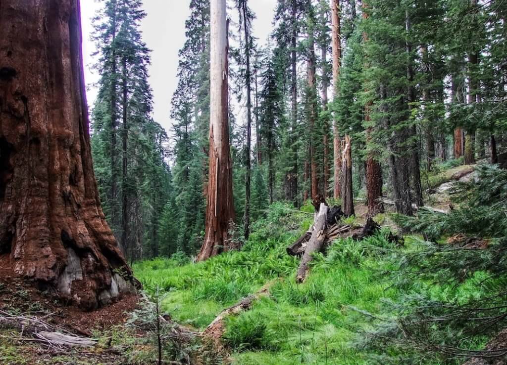
If the crowds at Grant Grove are taking away your enjoyment of the giant sequoias, then the lesser visited North Grove Trail was made for you. The noise of Grant Grove disappears as you make your along the path in the more natural setting of the grove. It’s one of the lesser known hiking trails in the Sequoia and Kings Canyon National Parks.
The trail head is located at the end of the RV parking area of Grant Grove. The closest restrooms are in the main parking lot of Grant Grove.
Park Ridge – .04 miles
A short uphill climb on a paved path takes you to Panoramic Point. Overlooking Hume Lake and Kings Canyon, the views are endless. And, you don’t have to work hard for the view. The path is fully accessible.
There’s the option to extend this into a proper hike by following the trail to the Park Ridge Fire Lookout (5.5 mile loop, moderate).
The trail head is located at the end of Panorama Road, just past the John Muir Lodge in Grant Grove Village in Kings Canyon National Park.
Roaring River Falls 0.3 miles

Ok, so this one really isn’t a hike. It’s a short-paved path to the falls. Roaring Falls is on the small size. But, it does earn its name. The falls are surrounded by large boulders allowing you to sit and enjoy the cooler air by the falls.
But, you can make this stop into a small hike. If you’re looking for a longer trail that’s still easy, there’s a connecting trail from the start of Roaring River Falls to Zumwalt Meadow. The entire trail is 3.9 miles in length.
The trail head is located off Highway 180 in Kings Canyon National Park.
Zumwalt Meadow – 1.5 miles
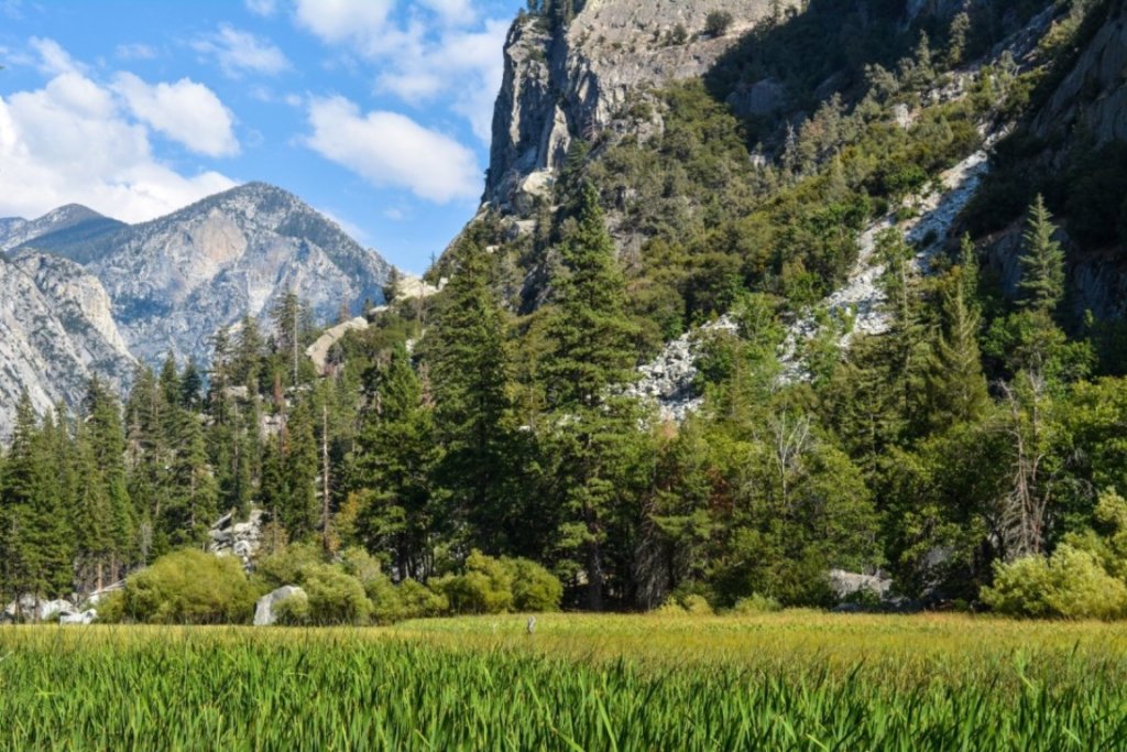
If there’s such a thing as perfection in nature, then the views at Zumwalt Meadow certainly qualify. They’re views of such beauty that I always make time for them when I’m in Kings Canyon. Even if you don’t want to hike the entire loop, those first views of the meadow after you cross Kings River can’t be beat.
The trail head is located off Highway 180 in Kings Canyon National Park. There are restrooms and picnic tables by the parking lot.
Moderate Hikes
Congress Trail – 2.7 miles

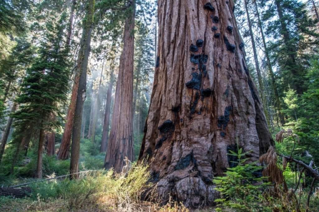
This is the most popular hiking trail in Sequoia National Park. Not far from the entrance stands the impressive General Sherman Tree, the largest tree by volume in the world. Interesting fact – the top of the sequoia is dead, so the tree doesn’t get any taller. However, it’s still growing wider at the base!
Sadly, a majority of people head down to the Sherman Tree, snap some selfies, and then leave. Please don’t be those people. The Congress Trail is amazing. It’s a fully paved path that takes you deep into the Giant Forest. Along the way, you pass by the President Tree, McKinley Tree, the Congress Group, and the Senate Group (my favorite grouping). Deer are also popular in this area.
At over 7,000 feet in elevation, you’ll need to take the path slowly if you’re not used to being at such an elevation, especially at the uphill to get back to the start of the trail.
The turn off to the Sherman Tree is off the General’s Highway, a few miles away from the Giant Forest Museum. Handicap parking only is available directly off the General’s Highway. Restrooms and water fountains are at the trail head.
Buena Vista – 2 miles

One of my favorite hiking trails in Sequoia National Park, I always make time for Buena Vista whenever I visit. It’s a short, uphill hike to the outlook. And, Buena Vista earns its name. The view is incredible. And, on a clear day, it’s never ending. To your left is Big Baldy, below you and to your right is the Sugarbowl, a grove of Sequoias. Behind you is the ridge line of Kings Canyon. With plenty of large rocks up top, it’s a perfect place to picnic.
Trail head is located directly off the General’s Highway. There are no facilities at this trail.
Little Baldy – 3.4 miles
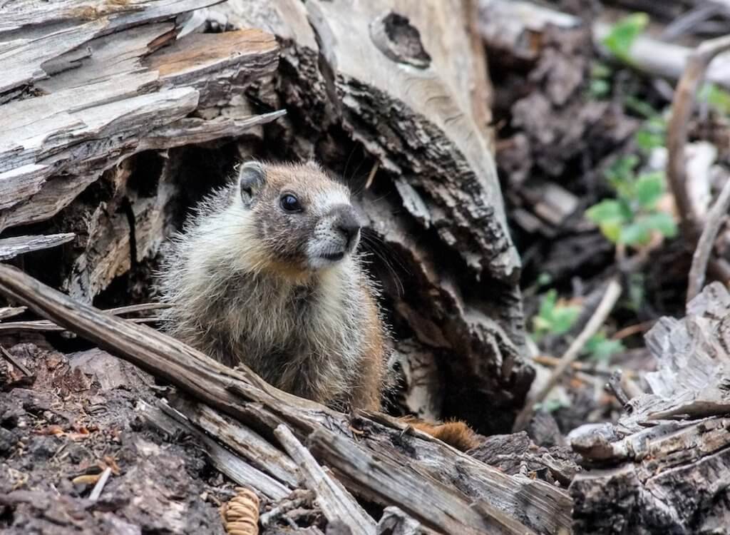
This delightful hiking trail in Sequoia makes it way via several switchbacks to the top of Little Baldy. From atop Little Baldy, you have views of the Great Western Divide. Along the way, you’ll also see Big Baldy and Chimney Rock. Perhaps you may even encounter a marmot along the path.
Trail head is directly off the General’s Highway. There are no facilities at this trail.
Big Baldy – 5.6 miles
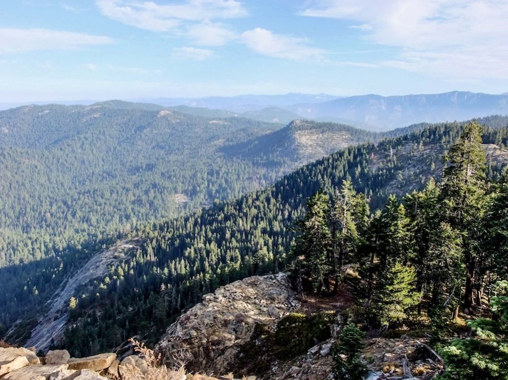
For a little bit of effort, you’re rewarded with views for days along the Big Baldy trail. This hike in Sequoia gains about 600 feet as you work your way to a max elevation of 8,200 feet. From above, you’ll see the peaks of Kings Canyon, Castle Peak, the Great Western Divide, Alta Peak, and Sawtooth Peak (just to name a few). Of the two baldy trails, this one is the more popular. And, once you’ve hiked it, you’ll know why.
Trail head is directly off the Generals Highway near the Montecito Lodge. There are no facilities at this trail.
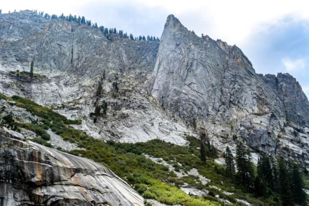
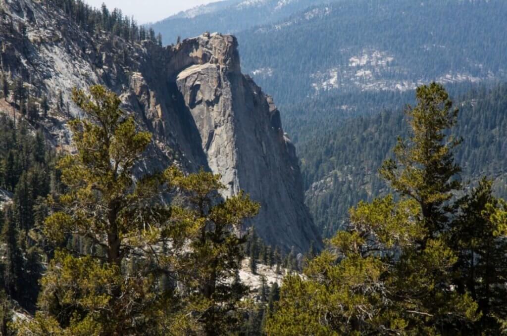
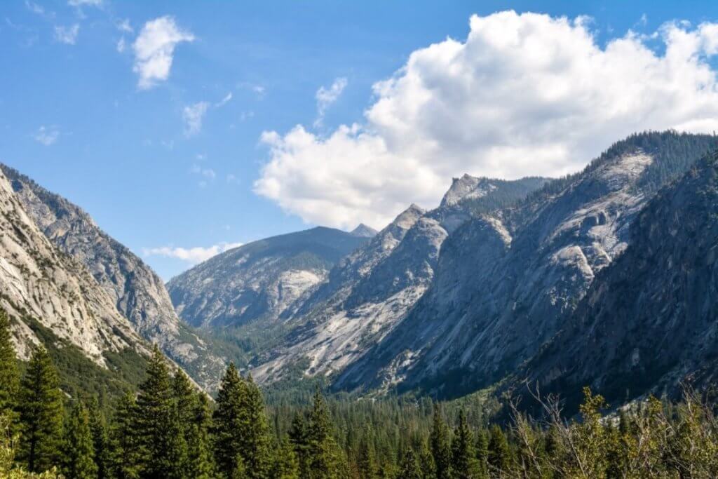
Mist Falls – 8.1 miles

One of the most popular trails in Kings Canyon National Park, is the trail to Mist Falls. The beginning of the trail is a bit of a bore. But, after the first mile, the scenery greatly improves. It remains mostly flat for the first half. But, then, you begin to gently go uphill. The views behind you of the Sphinx are impressive. And, for me, that beats out the view of the falls themselves.
If you want a longer hike, you can continue on the trail for another two miles to Paradise Valley. Or, to have some variety on the way back, take the spur to the Kanawyer Loop Trail for better scenery along the river to trail’s end. Going this way adds about 0.5 miles to the journey.
Trail head is located at Road’s End parking area in Kings Canyon National Park. There are restrooms in parking lot.
Difficult/Overnight Hikes
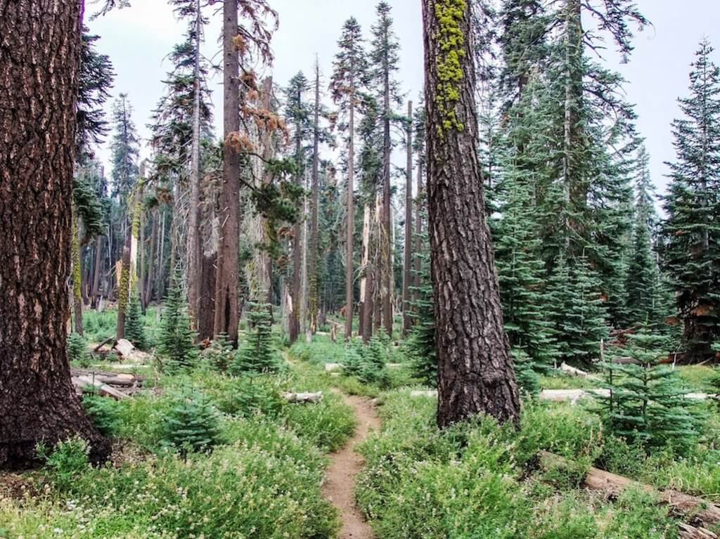
Trail of the Sequoias – 7.0 miles

This hiking trail in Sequoia is an extension of the Congress Trail (and total distance of this trail includes the Congress Trail). Rather than an easy, wide, paved path along the giant sequoias, the Trail of Sequoias takes you through dense forest to see the sequoias in a more natural and quiet setting.
This trail, at its furthest reach, passes by Tharp’s Log and Chimney Tree. So, you can either stay on the trail, or you can opt to detour to go around either Log Meadow, Crescent Meadow, or both.
When on the Congress Trail, the Trail of the Sequoias starts at the Chief Sequoyah Tree located next to the President Tree.
Hart Tree Trail – 7.2 miles / Sugarbowl Trail – 6.4 miles
Two of the best hiking trails in Sequoia National Park are the Hart Tree and Sugarbowl Trails. Both trails pass through the largest sequoia grove on the planet. The untouched forest is the perfect surrounding for these red giants. And, whichever trail you chose, you’re immediately floored by the sequoias as soon as you start the trail. If you want to admire the sequoias without the crowds, these are the trails for you.
The Hart Tree once had the distinction of being the fourth largest sequoia in the world. Sadly, it’s been moved down the list. But, it’s still worth a look. Along the forested trail, you pass abandoned tree cabins and creeks and views of Bunea Vista Peak. The Sugarbowl is a reference to a dense area of sequoias. Whichever trail you choose, you can’t go wrong. Or, these two trails can be combined to make for a longer loop.
To reach either trail head, turn onto Redwood Saddle Road from the General’s Highway. It’s 2-miles on an unpaved road (two-wheel vehicles are OK). Both trails start from the parking lot at the end. There’s a toilet by the parking lot.
Lakes Trail – 12 miles
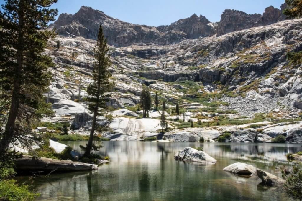
It took me three tries to complete this trail. The first time, I had to turn back due to my fear of heights. The second time, altitude sickness started to set in. Third time was the charm! And, there are few trails that I’ll try to do repeatedly. But, the Lakes Trail was well worth the wait and effort. On this trail, you see a completely different side of Sequoia National Park while venturing into the High Sierras.
For a majority of the this hiking trail in Sequoia, you’re steadily gaining 2,000 ft of elevation (ending at about 9,200 feet). The first part is through a forested area. But, the real fun starts when you emerge at the top of the Watchtower. The view of the Tokopah Valley takes your breath away. The trail then follows along the cliff face (it’s a nice drop of about 2,000 feet if you fall) until you reach Heather Lake, the first of three lakes on this trail. If you’re uncomfortable with heights, or the Watchtower portion of the trail is closed due to ice, you can take the Hump Trail to Heather Lake. Just be warned, it’s a lot steeper.

Heather Lake is a wonderful spot to cool down, take a dip, or just relax. Many hikers choose to only go as far as Heather Lake before turning back. Continuing, the trail offers great views of Aster Lake, before it descends to Emerald Lake. This was my favorite lake. Can’t tell you why exactly, but it’s just stunning. And, more tranquil than Heather.
It’s another mile to the final lake, Pear Lake. And, it’s a difficult mile as it’s all uphill. But, along the way there are incredible views of Aster Lake and the Watchtower. And, the feeling of satisfaction and accomplishment you get when you’re standing at water’s edge at Pear Lake…well, that can’t be beaten. I did a celebratory dance (no lie)! Not everyone makes it to Pear. But, its completely worth that extra bit of effort. For me, it’s one of the best hiking trails in Sequoia National Park.
This trail can be done as a day hike. Or, you can break it into an overnight stay. Campsites are available at Emerald and Pear Lakes (permits required). Pit toilets are located at both lakes, too. Access to the trail is at the Wolverton parking lot past the General Sherman Tree. Restrooms are available in the parking area. Bear boxes are also available.
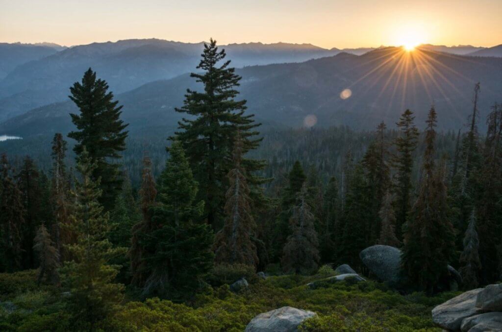
Alta Peak – 13 miles
Admittedly, I haven’t done this hiking trail yet. But, it’s on my list. This trail takes you to the top of Alta Peak (only 11,000+ feet tall), gaining over 3,000 feet in elevation along the way. But, you can see most of the park from the top on a clear day. Even, all the way to Mount Whitney (one of the rare places in Sequoia where you can see the tallest point in the lower 48 states).
Access to the trail is at the Wolverton parking lot past the General Sherman Tree. Restrooms are available in the parking area. Bear boxes are also available.
Bear Meadow – 23 miles/High Sierra – 72 miles (one way)
If you’re thinking of hiking the Pacific Crest Trail, a warm-up hike to consider is the High Sierra Trail. This gem of a trail traverses the ridge lines in the Sierras. The trail head is located at Crescent Meadow in Sequoia National Park and takes you east all the way to Mt. Whitney, the tallest summit in the lower 48 states. For more information on the High Sierra, check out route info here.
If 72 miles seems a bit much, you can enjoy a shorter jaunt on the High Sierra to Bear Meadow. This is one hiking trail in Sequoia that I can’t wait to do. With only a gain of 1,100 ft. in 11.5 miles, you get a taste of the untamed Sierras without great exertion. Once at Bear Meadow, you can take in a bit of glamping with upscale tents and gourmet meals freshly prepared. Reservations must be made well in advance. You can find more info here.
Copper Creek – 20 miles
For some of the best views in Kings Canyon National Park, Copper Creek is the one to do. If the thought of a grueling 20-mile hike seems overwhelming, it’s still worth it to hike the first 1-2 miles of this trail. The views of Kings Canyon stretch on in either direction.
The start of the trail is nothing but endless switchbacks. Eventually, the path straightens for a bit through a forest allowing for some much needed shade. You pass by the Lower Tent Meadow. But, it’s the views from the Upper Tent Meadow that make this trail worth the effort. Continuing, the trail ends at Granite Lake.
Going to trail’s end, you’ll have gained over 5,000 feet in elevation and climb to a height over 10,000 feet. The nice thing about the trail is that it is a steady climb up. At no point does it get extremely steep. It stays constant, which helps you pace yourself. In addition to black beers and deer, rattlesnakes are frequently encountered in the lower portion of this trail.
Trail head is located at Road’s End in Kings Canyon National Park. Restrooms are located in the parking area. Bear boxes are also at the trail head. This can be done as either a long day hike (especially if just going to Upper Tent Meadow) or you can camp at Granite Lake (permit required).
Need to Know
Location
Sequoia and Kings Canyon National Parks are in California. Yosemite National Park is roughly a 2.5 hour drive north. The parks are roughly:
- 200 miles from Los Angeles, CA
- 240 miles from Sacramento, CA
- 260 miles from San Francisco, CA
- 390 miles from Las Vegas, NV
Entry Fee
Entry into the park is $35 per vehicle. It’s valid for 7 days and grants entry into both Sequoia and Kings Canyon National Parks. You can purchase your pass online in advance here. Entry is free if you have valid American the Beautiful interagency pass.
Lodging
Hotels – Several hotels are situated inside Sequoia and Kings Canyon National Parks:
Wuksachi Lodge: This high-end hotel is near the Giant Forest in Sequoia National Park. Built in 1999, you won’t feel like you’re roughing it. It’s situated at an elevation of 7,200 feet and is open year-round. Reservations can be made here.
John Muir Lodge: Located in Grant Grove Village is close to the General Grant Tree. Built in 1998, the lodge is a rustic retreat fitting for a national park. Reservations can be made here.
Grant Grove Cabins: If you’re looking for something between a hotel room and traditional camping, try the Grant Grove cabins. Located near Grant Grove Village and the General Grant Tree, these cabins have been in the park since 1910. Reservations can be made here.
Cedar Grove Lodge: Located in the heart of Kings Canyon, Cedar Grove Lodge makes for a great base for exploring the many trails near Road’s End. The rooms are basic but comfortable. Reservations can be made here.
Montecito Sequoia Lodge: This rustic lodge is located in middle of Sequoia National Park. And, it offers all-inclusive rates to its guests. The property even includes its own private lake with views of the Western Divide. The lodge is open all-year. Reservations can be made here.
Stony Creek Lodge: Though this hotel is outside the park boundary, the only way to access it is from the General’s Highway in Sequoia. It’s ideal location in the middle of park makes it a great base for anywhere you want to go hiking in Sequoia National Park. It’s always my lodging of choice. Reservations can be made here.
Outside of the park, your best bet for hotels is in Three Rivers just outside the southern entrance to Sequoia National Park.
Campgrounds – There’s no shortage of camping options in both Sequoia and Kings Canyon National Parks. Campgrounds are found in the Lodgepole, Grant Grove, Cedar Grove, Mineral King, and Foothills areas of the parks. Some require reservations and others are first come basis. For more information on each camp site, go here.
Services
Cell phone service is intermittent within the park. Plan on having no service while hiking in Sequoia and Kings Canyon. There’s only one gas station in the park. It’s located in front of the Stony Creek Lodge in Sequoia. It’s best to enter the park on a full tank.
Food is available at the Lodgepole Visitor Center (both restaurants and camp store), Grant Grove Village (restaurants and camp store), and Cedar Grove (restaurant – limited hours).
Permits
Every overnight stay on a trail requires a permit. Day hikes do not require permits. Permits are available all year. However, during the summer, there is a quota on how many people are allowed on the trail per day. To hike during that time, you’ll need to submit a wilderness permit at least 2 weeks in advance of your hike. To help plan the perfect retreat on the trails, checkout the Wilderness Trip Planner that’s full of useful information including campsites, trails and daily quotas, mileage, and elevation. Outside the quota season, wilderness permits are available at any Visitor Center or Permit Station and are free.
Wildlife
One of the best parts of being in nature is seeing wildlife. And, there’s no shortage of wildlife in these parks. You’re bound to see plenty while hiking in Sequoia and Kings Canyon. PLEASE DO NOT FEED THE WILDLIFE. Keep the animals wild and safe from danger and do not feed them. Additionally, keep your distance from animals. For larger animals, like deer, you should remain at least 25 yards away.
Black Bears
Both Sequoia and Kings Canyon National Parks are home to the black bear. While hiking in Sequoia and Kings Canyon, there’s a good chance that you may encounter one. Generally, they have no interest in humans. But, know your bear safety tips. Keep at least 100 yards away from bears. And, do not allow them access to any of your food. If bear boxes are available at the trails, place all food from your car into the bear boxes. Bears have an amazing sense of smell. And, bears will break into vehicles in search of food (and insurance will not cover bear damage). While hiking, shout out every few moments so nearby bears know of your presence. You never know how a startled bear will react.
Credit
https://theunendingjourney.com/
